By C. L. Wright
The Geology of Utah's Rivers is a topic that one can easily spend years and years and years trying to learn, only to wake up the next day and hear a new theory that makes more sense than the one you've been telling people about for the past several seasons of guiding. A few formations are easily recognized and learned quickly, while others that are thinner or rarer may be harder to learn. Some rather prominent formations are called different names by different geologists. Others rest "comfortably" on top of each other, and represent a smooth transition of similar environments, say, marine limestone for example, and the exact moment of contact from one to the other is practically impossible to pin point.
And once (or if?) one begins to feel comfortable with stratigraphy (the study of different rock layers what sorts of environments they represent), much larger and often more vexing questions of geography remain. The rivers on the Colorado Plateau curiously cut through a large number of uplifts, plateaus, cliffs, anticlines, and mountain ranges that it seems they should naturally be inclined to flow around. Numerous theories over the years have been advanced to explain these feats of canyon cutting. Paleogeography - the study of ancient geography, becomes key to understanding the present geography. Eventually one may come to know more about seas and rivers and sediments that no longer exist than the contemporary ones one is floating down. Differentiating the contributions various scientists, with their own names and competing theories, takes of course even more time to master. The ambition to accumulate a totality of knowledge of these landscapes can easily, and elusively, become a live long goal.
Happily surprised, I recently came across a copy of William T. Parry's Geology of Utah's Rivers at the outdoors store in Kanab....
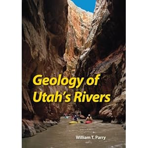
The cover photo instantly grabbed my attention- kayakers running through the deep, narrow, eight-foot wide channel of Muddy Creek as it carves its canyon through "the chute" in the San Rafael Swell- a trip that I've been longing to accomplish for years and had to abort the one time I was actually able to try it. A flip through the contents reveals the author has not only concentrated on the larger rivers- the Colorado and the Green- but a whole section of smaller rivers and creeks highly popular with kayakers, as well as others, such as the Duchesne and the Strawberry, that I've seen when they were high and looked runnable but never actually heard of anyone running.
I was sure I could learn quite a bit from this book, though I doubted that the whole story of any of these canyons could be told in one volume only 188 pages long. Positively, reading this volume will improve one's understanding of the geology of Utah's rivers. Specifically, the author is most helpful as he focuses most of his attention on the evolution of today's rivers and the paths they have come to take. How did the Colorado cross the salt anticlines? What are the theories about the Green's crossing of the Uinta Mountains in Lodore Canyon? And just what is that beautiful rock on the books' front cover? Is it Kaibab sandstone or Black Dragon Dolomite? White Rim or Coconino Sandstone?

(Above, the Green River as it winds through Lodore Canyon, cutting directly through the Uinta Mountains, which rise for thousands of feet above the river. It is thought the Green once flowed to the East to join the Platte and drain into the Mississippi, before cutting the canyon to join the Yampa and Colorado to the South. Geologists and Geographers debate whether headward erosion from a Yampa tributary, or the accumulation of fluviate Browns' Park formation and Bishop Conglomerate within the Brown's Park Graben eventually raised the pooled up Green's river level to the height of the lower Uinta slopes, allowing it to spill over them into the Uinta Basin and begin cutting Lodore Canyon. )
Reading the book answersed many of these questions for me, and for that I was grateful. However, all too often it seemed revelation was coupled with a degree of frustration. What benefit does it do me to be told something is "Permian Black Dragon Dolomite" but not to have anywhere a detailed explained what Black Dragon Dolomite is? Is that the same thing as the rocks in Black Dragon Canyon you see from the overlook on the East side of the San Rafael Swell just after you cross the Reef on Interestate 70? An earlier book I read told me about a Black Dragon member of the Triassic Moenkopi Formation. Is that the same thing as this Dolomite? Is that then younger or older than the equally mysterious "Sinbad member" of the Moenkopi, also apparently visible from the same roadside pull over, which presumably Muddy Creek would have cut through as well, but which is not specifically mentioned? A lack of detail to and good explanations of stratigraphy is the chief weakness of this book that runs like a curse through every chapter.
If you are already having trouble following my throwing around of obscure formation names, you will probably struggle with this book. Complex geologic language is used, but not explained at a pace that I suspect most of the kayakers on the books' cover would be able to follow. To the author's credit, a glossary is included. But even there, technical terms that would take much more than a paragraph a several analogies to explain threaten to leave the reader baffled. I challenge anyone to spend an hour staring at the definitions of "forebulge high", "foredeep basin", "foreland basin", and "foreland buldge" on page 195, along of course with the "back-bulge basin" from page 192 ( "a shallow, broad zone off flexural subsidence toward the continent from a forebulge high", of course!), and be able and the end of it all to tell me what any of them means.
For each river section the author has included a geologic map of the river area, side by side with a relief map to which the geologic map can be compared. Obviously, this is welcomed and helpful. Yet here again, the maps are deceiving. They are all birds' eye view maps, and drawn over a large scale of dozens of square miles. On this scale it is impossible to draw and label any cliff forming formations accurately, which of course is exactly what river runners spend most of their day staring at and wondering about.
For example, the "Moab Daily" stretch of the Colorado River from Hittle Bottom to Takeout Beach- perhaps the one stretch of river in the entire state run by more people each year than any other- gets a very skimpy treatment of less than a page. The author does discuss some of the curious faults and anticlines in the Professor Valley area that you may or may not notice from the river, (ever seen anyone point to the "Onion Creek Diapir" and ask about it?) where they often appear more as naturally eroded valleys than collapsed anticlines. However, Parry's map is unable to show the prominent (and for rock climbers, super important!) Wingate Sandstone, which of course is so cliffy as to be impossible to fit on the map he has included, and the extremely economically important Chinle gets lumped together with the Moenkopi, the deposition of which took place in a very different, and older, environment. At best, strata are named. But they are never explained in detail. Here, a river level photograph and stratigraphic labeling would have been much more helpful than an overhead map, as river level stratigraphy is exactly what one notices and what is novel about any river trip through a canyon.
Ahh! But we do learn, after all, that the Dolores River, which innocuously comes into the Colorado just above Dewey Bridge on a section (Cisco to Dewey) that probably sees the least user days per year of the entire Colorado River from Grand Junction to Hite, is antecedent to the Dolores salt anticlines!

(Above: late afternoon at the popular put in of Hittle Bottom on the Colorado River, as seen from the boat launch area. The top 30-40 feet of the red cliffs in the distance is Jurassic Kayenta Formation. Below it are steep cliffs of Wingate Sandstone, followed by slopes of older Triassic Chinle and Moenkopi, and Permian Culter Formation. River level is here in the Cutler and by Takeout beach is back through the Moenkopi and into the Chinle. About a mile and a half into the trip thick cobbles in the Culter on the left side of the river mark the location of an anicent stream channel that flowed long before the time of the dinosaurs. Hiking along the numerous washes carved into the Cutler, rocks with prominent ripple marks are often found.)
William T. Parry is a very knowledgeable geologist and a professor emeritus at the University of Utah. But he does not come to this book as a river runner writing for river runners. In a completely unsatisfactory way he attempts to explain this in the introduction, "This book is meant as a guide to the geology of the river for hikers, fishermen, boaters, and others. It is not a river guide suitable for bend-to-bend, rapid-by-rapid white-water boating... more detailed river and fishing guides should be consulted for this purpose..." (3).
At long last, indeed, I have received a book "meant as a guide" about the river that "is not a river guide". In so excusing himself the laborious tasks of including smaller scale geologic maps, any river level pictures with labeled stratigraphy, or at least an occasional correlation of geographic features with the river mileages currently in use, Parry steps back from the edge of creating an extremely useful and long over due guidebook, and in its stead, settles. It must have been possible at some stage of development to make this an extremely useful and accessible river- running book, particularly with regard to the smaller streams, such as Muddy Creek, or Sevier, Weber, or Provo Rivers, all of which have short, highly overlooked, and exciting boating seasons. Information such as put ins and take outs, or minimum recommended water flow in cubic feet per second, would have been very much appreciated and would not have taken up much additional space to include.
Is then, that glorious cover image not misleading, of several kayakers running the chute in Muddy Creek? Muddy Creek flows for over 60 runnable miles above its confluence with the Fremont where it becomes the Dirty Devil River. In Parry's book the entirety of this section receives a scant half a page in text and only one very large scale map! Did that picture of the kayakers on the cover mis represent the book as one meant for river runners? I think it did.
Parry's discussion of terraces (old river sediments left high along cliff walls from an earlier time before the canyons were as deep), river ages and aging, and particularly, the competing theories of antecedence and superposition (was the river there before the feature it cut through was lifted up from under it, or was the feature created first, and then buried in overlying sediment which the river cut through before cutting through the feature?) are well explained and make the book a great asset to someone already familiar with the basic geology of Utah's rivers who is looking to expand their knowledge. I certainly learned more about the Browns Park Grabben, Browns Park Formation and Bishop Conglomerate (all key to the paradoxical cutting of Lodore Canyon) from this book than any other I have read. And I greatly appreciated the chapter on the mythical "Rio De San Buenaventura"- first named by Spanish explorers in 1776 who were crossing the Green near present day Jensen, and imaginatively interpreted by various cartographers over the next 68 years who confused it with the Sevier and ultimately had it draining the Great Salt Lake into San Francisco Bay.
These advantages notwithstanding, I do feel that The Geology of Utah's Rivers does not live up to its name, nor the river- running orientation suggested by the cover photograph. I would hesitate to recommend it to someone not already familiar with the area due to the complexity of the language used and the sheer amount of information trying to be crammed into far too little space. For now, the void in comprehensive riparian geologic literature for the state remains unfulfilled. What we have to work with are a series of volumes in basic regional geology, scattered through various libraries (including those we bring on the river). A true synthesis has yet to be written, though within the next few decades we may be likely to see one. At that point, we may look back on Parry's work much as Parry looked back on those early explorers of the Great Basin and the imaginative cartographers of the Buenaventura, whose works promised so much, yet ultimately failed to deliver.
No comments:
Post a Comment